Valle delle Ferriere
through Scala and Ravello
Explore the hidden magic of the Valle delle Ferriere: a trek among ancient
treasures, among the ruins of the iron processing factories and the vestiges of the ancient paper mills.
A journey into the past that reveals the eternal beauty of nature and the craftsmanship of centuries ago.

Type of path
Departure location: Ravello
Arrival location: Pontone

Difficulty
Medium (Hikers)

How long it takes
4h30 (excluding stops) – 10 km

Altitude difference
Maximum altitude: 470 mt
Minimum altitude: 10 mt
Path information
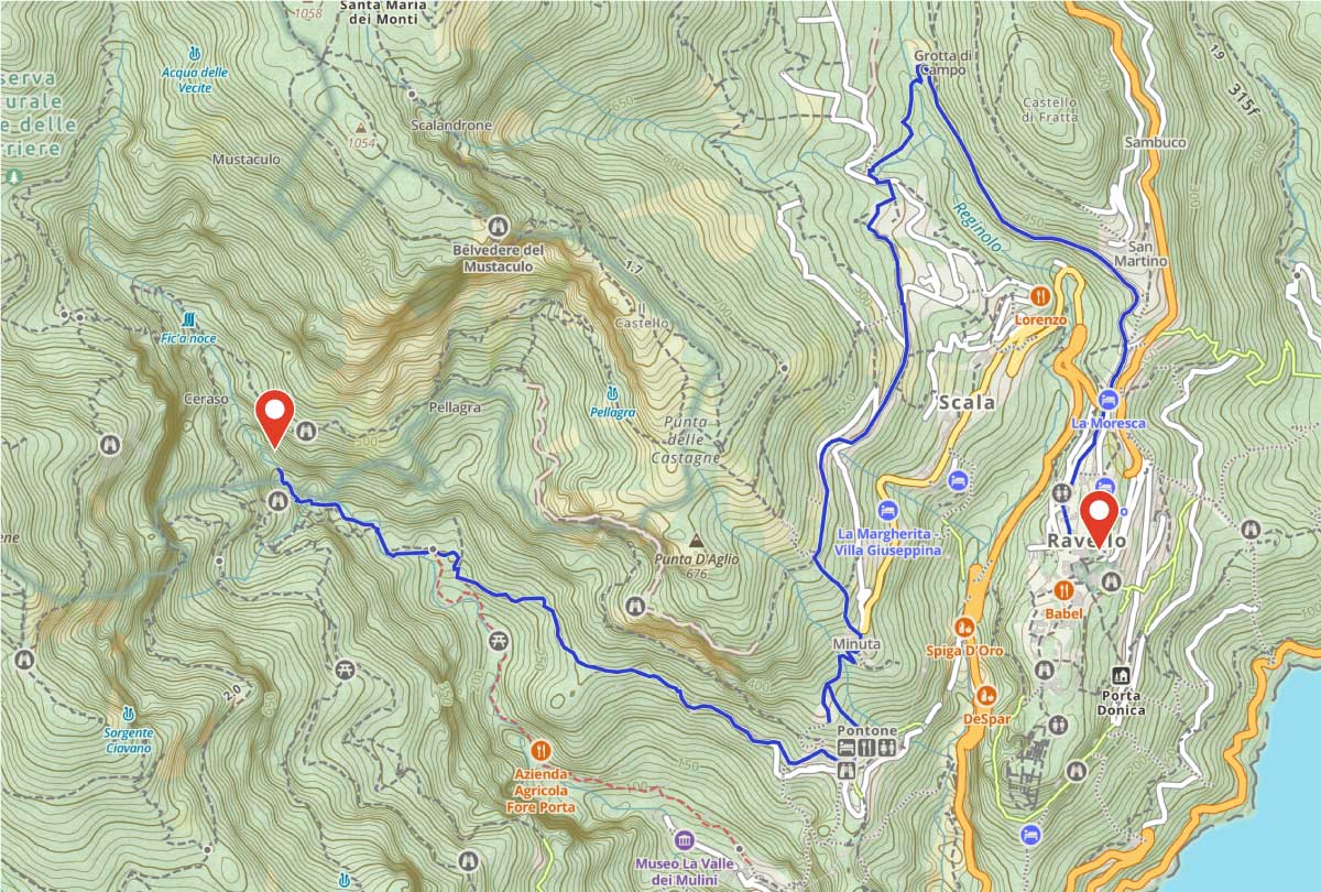
We will discover the Valle delle Ferriere, (Valley of Ironworks), an enchanting natural reserve that extends from the Scala mountains down to the Amalfi area.
This place of pure beauty offers spectacular waterfalls, a rich variety of flora and fauna, including the rare giant fern Woodwardia Radicans, a living testament to preglacial flora, and s well as the breathtaking views of the Amalfi Coast.
The excursion begins in Piazza Duomo of Ravello, walking through the ancient city walls and the narrow roads of the historic centre until reaching Piazza Fontana.
Crossing the picturesque hamlets of Lacco and Casa Bianca, we will explore the Dragone Valley and reach the municipality of Scala, traversing two of its hamlets, Santa Caterina and Campidoglio from which you can admire breathtaking views of Ravello and the Amalfi Coast.
In the charming hamlet of Minuta we will find ourselves in front of the ruins of the once majestic Basilica of San’Eustachio, one of the architectural jewels of southern Italy. Its commanding location has spectacular views that embrace sea and mountains, from Mount Aureo to the picturesque hamlet of Pontone.
We will reach “San Giovanni” square in Pontone at 250 metres above sea level through narrow roads and stone steps, in the setting of a landscape characterised by the greenery of the terraces immersed in the lemon groves between the Canneto Valley (Amalfi) and the Dragone River (Atrani).
We will continue our journey along the path that will lead us to the Valle delle Ferriere, one of the most exciting nature routes on the Amalfi Coast, where the beauty of the landscape combines with the rich history and culture of the location.
A unique experience among the uncontaminated nature and hidden treasures of the Amalfi Coast that will leave you enchanted. Our excursion will end in the central square of Pontone.

Suggested equipment

Hiking shoes

Layered hiking clothing

Long trousers

Windbreaker or windproof cape

Headlamp

Telescopic sticks

Water (at least 1.5 lt) and packed lunch
Useful information
HOW TO GET BACK FROM PONTONE
It will be possible to walk back through the rolling road and internal stairs in about 40 minutes or by public transport (SITA SUD)
optional lunch at local activity
For those who wish, you can have lunch at a local restaurant. Contact me to find out more!


